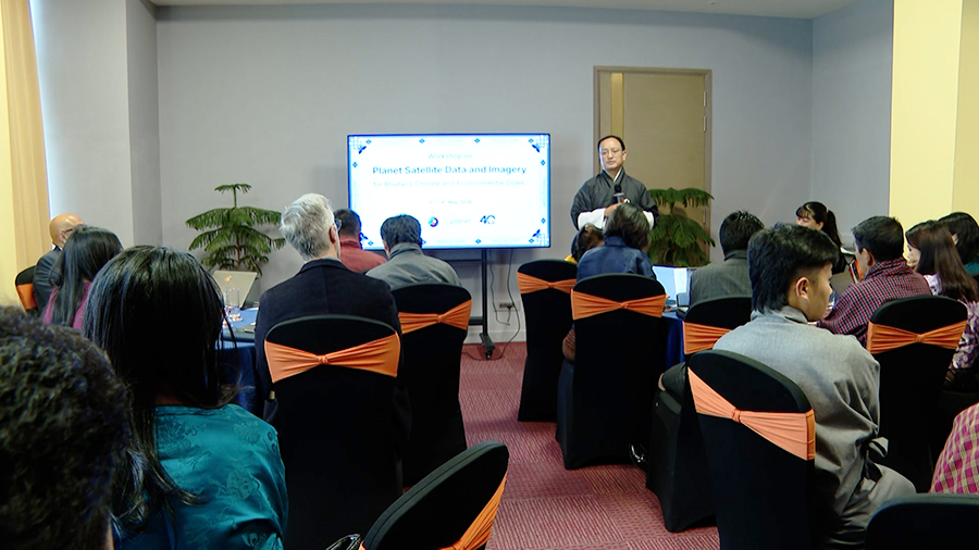
 Unpredictable rain, landslides and changing weather patterns are already affecting people across the country. For farmers, it means uncertain harvests and for travellers, it can mean blocked roads. To respond better, Bhutan is now turning to satellite technology. A training and consultation in Thimphu brought together experts and stakeholders to explore how this technology can support conservation, disaster preparedness and planning.
 Experts say satellite data gives a clear, country-wide picture. It helps identify areas at risk of landslides, forest fires and water shortages. This allows agencies to act early and prepare for emergencies.
The Bhutan Foundation and the National Land Commission Secretariat, in collaboration with Planet Labs, are leading the initiative.
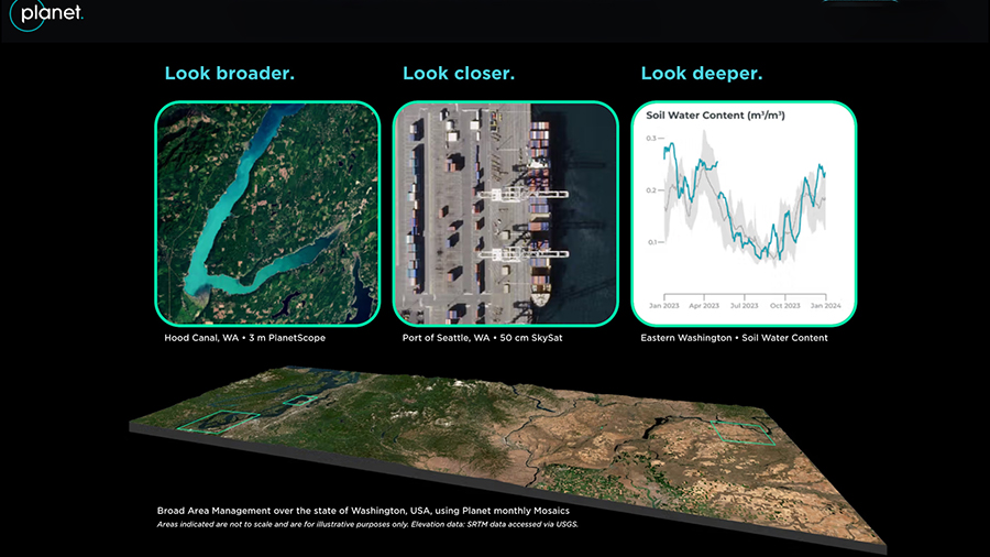
Planet Labs is a global satellite data company founded by former NASA scientists. The company provides frequent images that show changes on the ground almost in real time.
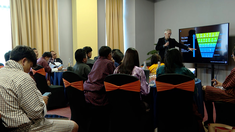 “Satellite data are critical for giving a bird’s eye view of the whole country and being able to give detailed insights into where risks occur and where different management activities need to happen. We know that landslides are a critical priority for the nominee regions here. So, being able to prepare for emergencies and even potentially for wildfire response, as temperatures warm and as some of the access to water becomes limited in forests, being able to have that common operating picture is critical to improve preparedness,” said Cristopher Anderson (PhD), Lead Scientist, Forest Ecosystems.
Access to such detailed data has been a challenge. Most agencies depend on expensive data or free images that lack clarity.
Through this initiative, Bhutan aims to secure high-resolution images, covering up to 15,000 square kilometres. This means officials can look at nearly 40 per cent of the total land in the country in a single image and still see fine details on the ground such as forests and rivers.
The data will be made freely available for three years by Planet Labs, and discussions beyond the project period have not yet taken place.
“We want to support the many different arrays of use cases, because information on the environment is useful for understanding water quality, for understanding carbon storage, for understanding forest health, and we think that we can really enable the multiple priorities of different agencies within the country,” added Cristopher Anderson (PhD), Lead Scientist, Forest Ecosystems.
“Even the technical entities like the Land Commission, the Department of Forest and Park Services, the Department of Environment and Climate Change, whatever data we have, we have to buy. We have to buy or use free open data, which may not be of a resolution that is desired. So, through this program, we are hoping that at least for the selected priority sites, we can get very high-resolution and precision data so that work on the ground could be better informed,” said Norbu Dema, Country Director, Bhutan Foundation.
Stakeholders say the initiative will greatly enhance their work.
“Through the project, which is called the ‘Restore Bhutan Project’, we aim to restore 50,000 hectares of Bhutan’s state forest land as well as private land through agroforestry measures. I feel that these images, that is, like 50-centimetre resolution, that is, really high-resolution images, can really provide deep insights in terms of how the condition of that particular degraded area is, in terms of knowing the condition and in terms of knowing where to undertake restoration activities,” said Sonam Wangdi, Chief Programme Officer, Bhutan Trust Fund for Environmental Conservation.
“The National Land Commission has the mandate to update the national land use and land cover mapping. For this purpose, since Planet Lab provides lots of satellite images varying from medium-range to higher-resolution satellite images, it will be of immense benefit to conduct this land use and land cover mapping. And in addition, Planet also provides lots of other planetary variables. For instance, they provide soil moisture content and the land surface temperature. These are important parameters which can be used in various applications,” said Samdrup Dorji, Chief of Geo-Informatics Division, Department of Survey and Mapping, National Land Commission Secretariat.
In the long run, officials say better information will mean safe communities, stronger agriculture and more effective climate action for the country.
Namgay Wangdi
Edited by Sonam Pem


