
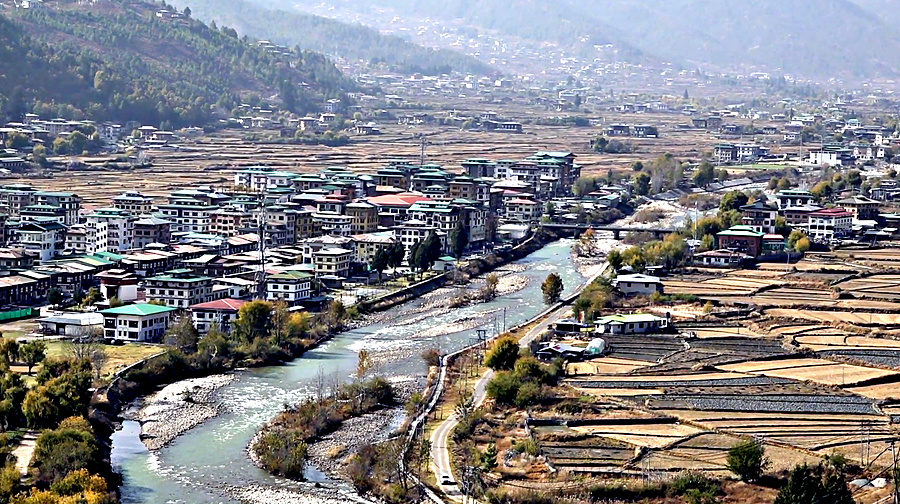
 Recent floods in Gasa and Punakha have raised concerns among the communities living along the river valleys. In Paro, where floods in August damaged two bridges, officials and residents came together to strengthen their preparedness for a similar disaster. Following a weeklong awareness programme, officials and communities living along the river identified safe evacuation areas, routes and ways to protect those most vulnerable.
The NCHM has identified 15 vulnerable sites and areas between Tsento and Chuzom in the district. They include Jagarthang, Nemjo and Changnangka, downtown Paro, Paro International Airport, hotels and other public facilities.
The risks include possible glacial lake outbursts and sudden increases in river levels caused by heavy rainfall.
Although Paro has an early warning system to monitor changes in the Pachhu, NCHM says the system has limitations.
Three automatic monitoring stations at Gunitsawa, Doteng and Bondey record river water levels every 15 minutes. However, this interval could mean missing rapid changes in water levels during the peak of a flood, making it difficult to determine exactly when the peak occurred and how high the water rose.
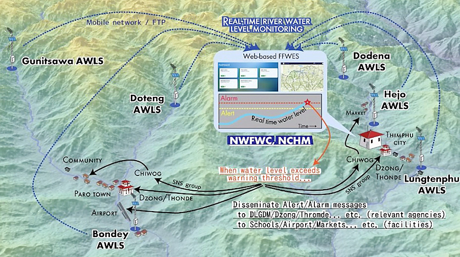
There are also no sirens to directly alert communities. Warnings are mainly shared through WhatsApp groups, which may not reach everyone, particularly at night when people could be asleep or miss phone notifications.
In response, the Paro District Administration, NCHM and the Department of Local Governance and Disaster Management are conducting a week-long awareness programme focused on practical flood preparedness at the community level.
Residents, particularly those living close to the river, are learning where to evacuate, which routes to take and how to assist elderly people and others who may need help during a flood.
“The most important thing we learn from awareness programmes like this is where to go during a disaster and what to take with us. We also learnt how to get elderly people to safety,” said Pem, a resident of Dopshari Gewog, Paro.
Officials say involving residents in identifying evacuation areas and routes is important to ensure that preparedness plans reflect the needs and circumstances of each community.
“We are first discussing with residents which places they consider safe and suitable as evacuation areas during a flood. Then we identify the routes they should take and who will help whom. Later, we will try to conduct a mock drill to put these discussions into practice,” said Tshering Dorji, Programme Officer with the Department of Local Governance and Disaster Management, Paro.
The information gathered from residents will be used to revise Paro’s Disaster Management and Contingency Plan, incorporating community-identified evacuation areas, routes and support arrangements.
The department also hopes to conduct a mock drill to test these arrangements and assess how effectively communities can respond to a flood warning.
Karma Samten Wangda, Paro
Edited by Sonam Pem