 Land owners across the country can now look forward to lesser to no fraudulent land transactions and stronger protection of property rights. This follows the launch of the new digital consent system by the National Land Commission Secretariat alongside a modernised surveying system designed to improve accuracy and security in land administration.
 Whether transferring land to children, selling a plot, constructing a house, or using land as collateral for a loan, people rely on accurate records and secure transactions.
However, concerns over land disputes, delayed services or in some cases where land ownership is questioned remains a challenge.
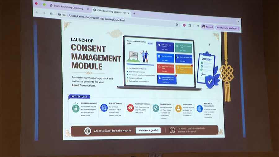
The National Land Commission Secretariat says its new digital consent management module is designed to directly address these risks.
The system requires consent from all relevant parties before a land transaction can proceed.
This means a landowner will have greater assurance that no transaction involving their land can be initiated without their knowledge.
The system uses Bhutan’s National Digital Identity platform, allowing people to verify their identity and provide consent securely online.
According to the land commission, this additional layer of verification is expected to reduce the risk of forged signatures, unauthorized transactions, and ownership disputes.
Officials say the system will make land transactions more transparent and provide greater protection for property owners.
Tshering Zam, the deputy chief land registrar of National Land Commission Secretariat said, “To date, consent verification has been based on paper documents. Anyone, sometimes even without the knowledge of the parties involved can forge documents, including internal agreements and NOCs. Even thumb impressions, which are required, can be forged. With this new consent management model, the system is expected to significantly reduce such fraud cases.”
She added that individuals who are unable to access the National Digital Identity (NDI) platform can visit their nearest land record office, where officials will assist them in providing consent.
The system will be piloted for three months in Thimphu, Paro and Phuentshogling before its nationwide implementation.
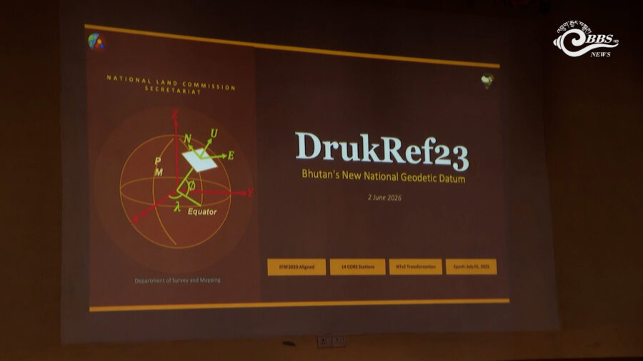 Alongside this, the secretariat has also introduced DrukRef23, a new system to measure and map land and infrastructure more accurately.
With the new system, surveyors will now rely on updated satellite-based reference stations spread across the country.
Pema Dorji, the survey engineer of National Land Commission Secretariat said, “For the past 20 years we have been using DrukRef03. Now we are transitioning to DrukRef23, which is more aligned with modern geospatial technology. Over the past 20 years, tectonic movement have occurred and DrukRef23 accounts for these changes. As a result, it provides more accurate geospatial data”
For property owners, these means more secure land ownership, fewer disputes, reduced chances of fraud, and more efficient land services in the long run.
Tashi Dekar


