
The National Land Commission is revising the Geo-Information Policy 2018 to improve data discovery, accessibility and sharing. The revision aims to reduce duplication, cut costs and keep up with the changing technology. The Commission shared an update on the progress on 21st November.
Geo-information captures, stores, analyses and displays data related to positions on the earth’s surface, making them essential for decision-making.
According to the National Land Commission, the Geo-information Policy 2018 requires a review to align with advancements in geospatial technology.
“We found that some of the clauses of the policy had to be reviewed and amended based on the recent development in geospatial technology. During this project, we reviewed and made a lot of recommendations for future review,” said Samdrup Dorji, chief survey engineer at the Department of Survey and Mapping, National Land Commission.
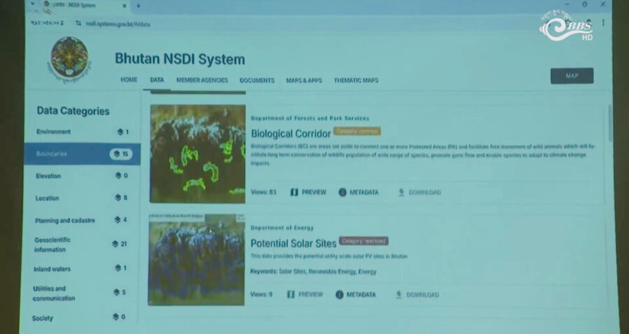 As part of the policy, the Commission is developing a National Spatial Data Infrastructure System, which is a data reservoir for storing all geospatial data on a single platform. The system, launching in January next year, will enhance urban planning, disaster management, resource management, transparency and collaboration.
In addition, the Commission has come up with a National Standard for geospatial data in line with the International Organisation for Standardisation or ISO Guidelines. The new national standard will facilitate data sharing between agencies.
At present, geospatial data is scattered across institutions with varying standards, and there is no unified system to track or access the information.
Sangay Chozom
Edited by Sonam Pem


