
Two sets of high-resolution satellite images were handed over to the National Land Commission Secretariat in Thimphu today. The images are of the north-central and major urban areas of Bhutan with more details of each location. The National Land Commission Secretariat says the delivered images can be used for various developmental plans such as disaster prevention, agriculture, water resource management, urban development and forest conservation.
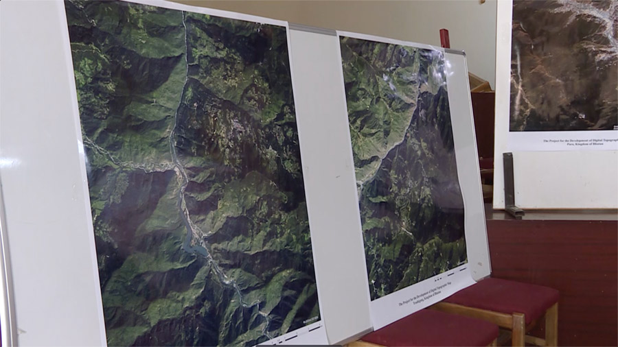 According to the National Land Commission Secretariat, the high-resolution satellite images will be used to develop a digital topographic map that will cover almost two-thirds of the country’s entire area.
The satellite image with a resolution of 1/25,000 covers the north-central region spanning some 17,000 square kilometres.
According to the Secretariat, a similar digital topographic map of the southern region was developed in 2017 using satellite images of resolution 1/25,000.
“Initially, we had 1:50,000 topographical maps, but now we are developing the 1:25,000 digital topographic map. So, compared to 1:50,000, 1:25,000 is considered a larger and higher resolution topographic map. So, this will be used across all the agencies and we are targeting to achieve 1 to 25,000 topographic maps of the entire country by 2025,” said Samten Dhendup, director at the Department of Surveying and Mapping, NLCS.
Considering more developmental activities taking place in the urban areas, the Secretariat is in the process of developing a higher resolution topographic map of 1/5,000 for Paro, Thimphu, Phuentshogling, Lhamoidzingkha, Sarpang, Bumthang, Monggar, Trashigang, and Gyalpozhing.
The official added that there is an ongoing project to further develop the topographic map for the northern region. However, the priority will be given to the south and central as these regions see more developmental activities.
The topographic maps will have a detailed and accurate representation of the locations as the commission along with the Japanese officials went to the site to survey and fix any distortion found on the satellite image.
“We are getting a raw satellite image. So once you get a raw satellite image we need to superimpose that to our earth’s surface. So when we superimpose over the earth’s surface we need to fix some prominent ground control points and ground stations. So for that, we need to go to the site and do some control point observation surveys. Then, based on that data these images will be super geo-referenced. So once it is geo-referenced then only we’ll be able to use it in the planning activities,” said Samten Dhendup, director.
He added the topographic maps will help create digital elevation models. This model, similar to a 3D model, will help get a better idea of the land while formulating development plans.
The satellite images were supplied by a Japanese company as part of the NLCS’s Project on Development of Digital Topographic Map. The project which started in 2022 is expected to be completed by next year.
Singye Dema
Edited by Phub Gyem


