
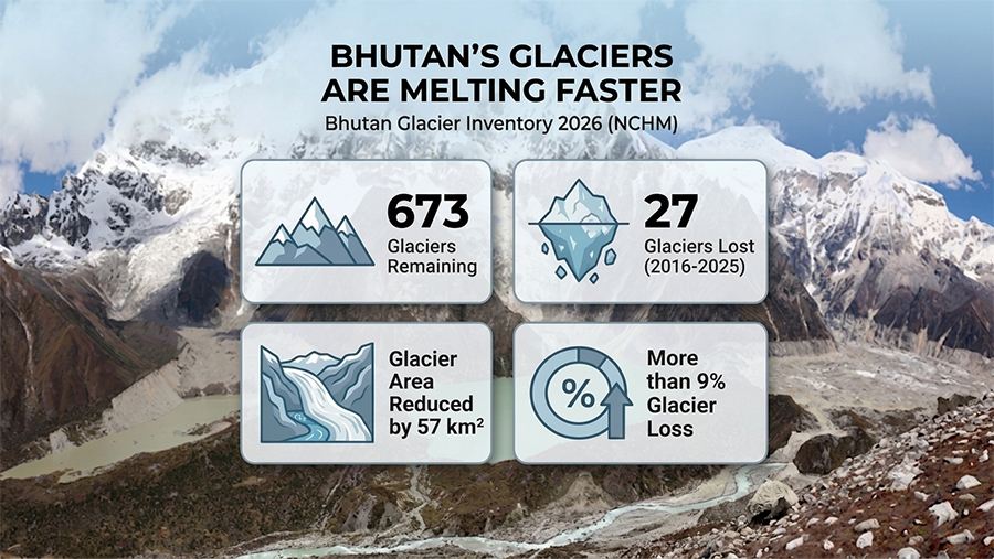
 Bhutan’s glaciers are melting at an accelerating pace. This is evident in the National Centre for Hydrology and Meteorology’s latest Bhutan Glacier Inventory 2026, which shows that the country has lost 27 glaciers in just nine years. The inventory highlights the growing impact of climate change on the Himalayas and raises serious concerns over the country’s long-term water security and the increasing hazard of glacial lake outburst floods.
Areas that were once covered by thick glacial ice nearly a decade ago are now exposed ground in some parts of the country.
The latest Bhutan Glacier Inventory shows that the country has 673 glaciers covering nearly 572 square kilometres. Since the previous inventory in 2018, Bhutan has lost 27 glaciers, while the country’s glacier area has shrunk by more than 57 square kilometres, or over nine per cent.
These findings are based on satellite images collected between 2016 and 2025.
According to the National Centre for Hydrology and Meteorology, the rapid glacier retreat is linked to rising temperatures in Bhutan’s high mountains. Temperature records show that Zanam in Gasa, the source of the Mangdechhu and located about 4900 metres above sea level, has warmed by 0.79 degrees Celsius between 2000 and 2025.
Similarly, Lunana recorded a temperature increase of 0.83 degrees Celsius over the same period.
Experts say glaciers are key indicators of climate change. In a stable condition, they maintain their size with snowfall adding about as much ice as is lost through melting.
“Bhutan, as a country itself, we are located in the Himalayan region. So, the warming part, under the impact of climate change, is taking place so rapidly in the highlands, especially. So, if you look at this temperature trend, the warming trend is quite rapid in that area, especially at high altitude. So, since the glaciers are located in the mountains, and the rapid warming trend is taking place in the mountains,” said Karma, Specialist, National Centre for Hydrology and Meteorology.
Experts say the shrinking glaciers could have far-reaching consequences beyond the mountains.
Glaciers feed Bhutan’s major rivers and help recharge springs and streams that communities rely on for drinking water and irrigation. As glaciers continue to shrink, these water sources could become less reliable.
“Indirectly or directly, we can say that all our major river systems originate from the glaciers up in the north. But more than that, I think we need to worry about water resources in the future. When the glacier disappears, I’m sure that in terms of water resources, there will be a huge impact, be it in hydropower generation or the energy sector,” said Karma, Specialist, National Centre for Hydrology and Meteorology.
The retreat is also contributing to the formation and expansion of glacial lakes, increasing the hazard of glacial lake outburst floods.
Despite the losses, the Pho Chhu sub-basin remains the country’s most glacier-rich area, with 200 glaciers covering more than 230 square kilometres.
The inventory was prepared using satellite imagery, along with machine learning and deep learning technologies. According to NCHM, the new approach improves the accuracy and consistency of glacier mapping while reducing human error.
Officials say the inventory will help improve climate research, water resource planning and glacial lake risk management as Bhutan continues to adapt to a warming climate.
Globally, studies suggest up to 80 per cent of today’s glaciers could disappear by the end of the century if current warming trends continue. In Bhutan, the National Centre for Hydrology and Meteorology has not yet projected the future state of the country’s glaciers.
Officials say different glaciers respond differently to climate change, and the centre plans to model some of the country’s major glaciers to better understand their future behaviour.
Namgay Wangdi
Edited by Phub Gyem