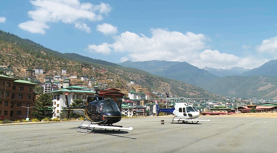
 Bhutan has started its first-ever airborne mineral exploration with the arrival of two specialised helicopters. The initiative aims to map the country’s mineral resources, an undertaking that the Department of Geology and Mines says is long overdue. Unlike previous studies focused on industrial minerals such as dolomite, gypsum, and limestone, this exploration aims to uncover precious and base metals that could be of economic significance like copper, gold, iron ore, and rare earth elements.
The one-year project has been contracted to Xcalibur, a globally recognised Australian smart mapping company. Xcalibur specialises in airborne geophysical surveys and has worked in over 80 countries.
Their specialised helicopters, flown by pilots licensed specifically for geophysical surveys, will fly at low altitudes to detect mineral signatures. Unlike conventional helicopters, these aircraft are customised to carry the sensors and equipment required for the survey.
“Bhutan may be small, but the entire country is our target for exploration. However, this survey will focus on lower altitudes, as flying above 10,000 feet requires specialised helicopters with more powerful engines than the ones currently in use,” said Phuntsho Namgyal, Director of the Department of Geology and Mines.
The exploration will begin in Gelephu and expand westward toward Wangdue Phodrang and Thimphu, while another helicopter will survey east toward Trashigang and Samdrup Jongkhar.
The resource prospectivity map generated from this survey will serve as a valuable tool for policymakers, investors, and stakeholders in the mining sector.
A mineral prospectivity map helps predict the chances of finding valuable mineral deposits in a region by combining geological, geophysical and geochemical data.
For centuries, Bhutan’s landscapes have held many secrets beneath its rugged surfaces. Traditional geological mapping required teams to walk miles through forests, cross rivers, and climb mountains in pursuit of understanding the wealth hidden beneath.
Due to the region’s rugged terrain, dense vegetation, and concealed geological features, traditional ground-based surveys have faced significant limitations.
It is also often time-consuming, labour-intensive, and limited in its ability to cover large or difficult terrains.
The Geological Survey of India last conducted a surface exploration in the 1970s in Bhutan, leaving the country without a comprehensive mineral prospectivity map.
Today, only 40 per cent of Bhutan’s total land area has been surveyed and studied in detail for its geological features.
The Department of Geology and Mines will now conduct a large-scale aerial survey to identify the country’s underground resources.
“For instance, if we have to do it on foot with our geologist team here, easily it’s going to take around 250 years to complete such a project. Because of the rugged terrain, and inaccessibility, it’s very difficult to do exploration. The advantage of this aerial platform is that helicopters can fly anywhere,” added the Director of the Department of Geology and Mines.
The 13th Five-Year Plan projects Bhutan’s mining and quarrying sector will nearly double, with its nominal GDP expected to grow from Nu 4.6bn in 2023 to a little over nine billion ngultrum by 2029.
Samten Dolkar
Edited by Sonam Pem


