 Imagine being able to plan road construction, protect farmland from floods, or respond faster to disasters, all by looking at a map. That is now possible in the country, thanks to new digital topographic maps. The Japan International Cooperation Agency, JICA, handed over two maps to the land commission today.
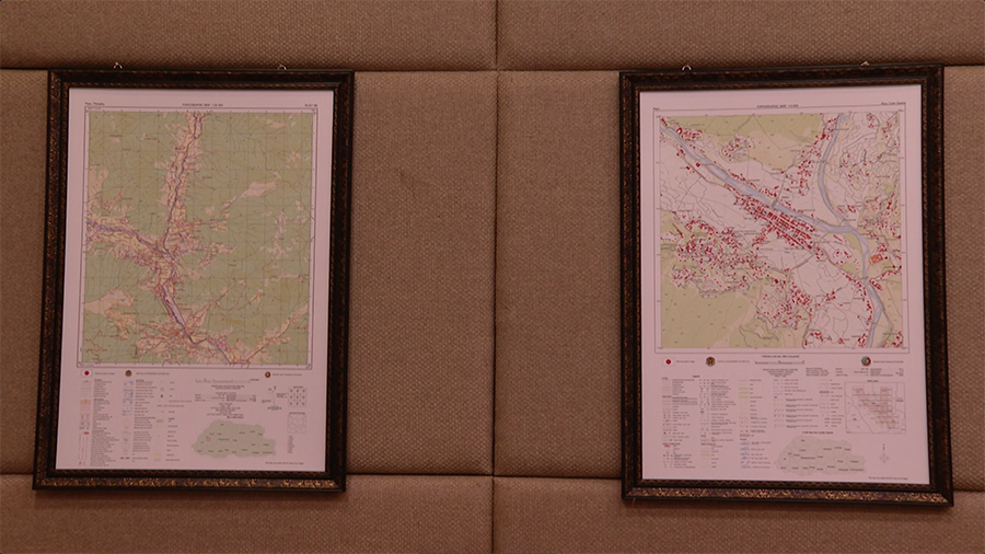
The maps were developed as part of the “Project for the Development of Digital Topographic Map in Bhutan.”
The maps cover 17,294 sq. km of the country’s north-central region at a 1:25,000 scale and 500 sq. km of nine key urban areas, including Thimphu, Paro, Phuentshogling, Bumthang, and Monggar at a 1:5,000 scale.
Officials said the smaller the ratio, the more detailed the map will be, including features such as land, buildings, rivers and roads among others.
Currently, Bhutan has a topographic map at a 1:50,000 scale, but it lacks detailed land feature information.
JICA officials said that the new maps, along with digital elevation models and satellite imagery, are expected to improve decision-making in key areas such as land planning, agriculture, disaster response, and climate resilience.
Yoichiro Kimata, Chief Representative of Japan International Cooperation Agency said “The topographic map serves as a fundamental base for multipurpose development. This data can be used for environmental monitoring, forest, disaster management, and also for promoting sustainable urban planning and development.”
Officials from the National Land Commission said that the maps would be made available to all government agencies and private sector.
Samten Dhendup, Director of Department of Survey and Mapping, National Land Commission said “Before, whenever we used to have some projects, we had to actually do topographic surveys for every location, and then a lot of time and resources had to be spent in preparing that topographic map and thereby, increasing the overall project timeline. Now, since we have the digital topographic map, it is readily available to all the government agencies and the private sector.”
This handover marks the final phase of the country’s geospatial mapping project with JICA, which started in 2015.
So far, about 30,000 sq. km of the country, which is around 77 per cent of the country’s land area, has been mapped on a scale of 1:25,000.
Kinley Bidha
Edited by Tshering Zam


